Thank you for your patience as we rebuild our website! 2020-2025
The “Remembering Shared Honor” (RSH) project sets out to collect and preserve oral histories related to Chinese and American cooperation during the Second World War in the China-Burma-India(CBI) theater of war.
This historical archive has a total of 7,078 entries.
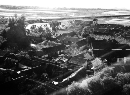
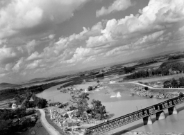
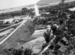
Bombing on Phu Lang Thuong railway bridge over the Thuong River at Bắc Giang City in French Indochina (Vietnam), during WWII. In northern Vietnam, and along a critical rail route used by the Japanese. Coordinates: 21°16'32.69"N 106°11'9.28"E
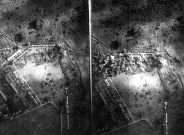
Bombing of Đáp Cầu railway bridge in French Indochina (Vietnam), during WWII. In northern Vietnam, and along a critical rail route used by the Japanese.
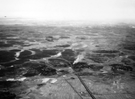
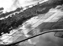
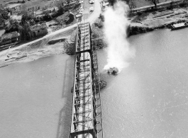
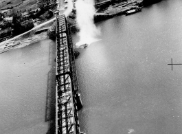
Bombing of Đò Lèn Bridge in Hà Trung Town in French Indochina (Vietnam), during WWII. In northern Vietnam, and along a critical rail route used by the Japanese.
Bombing of Đò Lèn Bridge in Hà Trung Town in French Indochina (Vietnam), during WWII. In northern Vietnam, and along a critical rail route used by the Japanese.
Bombing of Đò Lèn Bridge in Hà Trung Town in French Indochina (Vietnam), during WWII. In northern Vietnam, and along a critical rail route used by the Japanese.